!
Latest updates
Hua Hin Airport (HHQ): one scheduled route, and the international plan
Updated 15th Oct 2026
Surat Thani Airport (URT): the mainland way to Koh Samui, Koh Phangan and Koh Tao
Updated 15th Oct 2026
U-Tapao Rayong-Pattaya International Airport (UTP): who runs it and what is being built
Updated 15th Oct 2026
Nakhon Si Thammarat Airport (NST): the 2023 terminal, airlines and getting into the city
Updated 15th Oct 2026
Hat Yai Airport (HDY): terminals, getting into town and Bangkok flights
Updated 15th Oct 2026
Chiang Mai Destination Guide
Updated 3rd Sep 2026
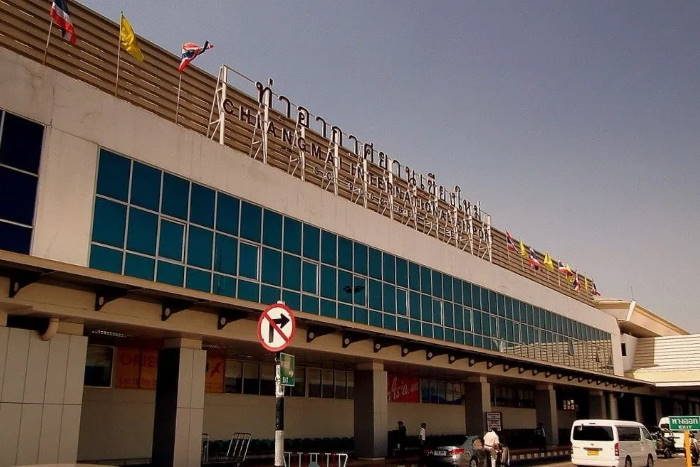
Chiang Mai was founded in 1296 as the capital of the Lanna kingdom, and the fortified city it began as is still standing. Walls stand on all four sides, restored in sections, five named gates survive, and the moats are now laid out as a city park. Doi Suthep rises to the west, the Mae Ping river runs down the eastern side, and Thailand's highest mountain is in the same province.
This page covers the city itself: how it is laid out, what is worth the walk, what to buy, how to get around, and the months when the air is at its worst.
Getting there by air
Chiang Mai International Airport (CNX) is operated by Airports of Thailand (AOT) and lies about 4 kilometres south-west of the old city, measured in a straight line to Tha Phae Gate on its eastern side. The nearer, south-western corner of the moat is closer than that. The Chiang Mai Airport page covers the terminals, the shuttle counters and the car park.
Bangkok Suvarnabhumi is 596 kilometres to the south-south-east and Bangkok Don Mueang 568 kilometres, which is typically about an hour and a quarter to an hour and twenty-five minutes in the air, against roughly ten hours twenty minutes to thirteen hours scheduled on the train. Which airlines fly the route, and from which Bangkok airport, is the subject of the Chiang Mai flights guide. The schedule itself sits on the Bangkok to Chiang Mai route page.
When to visit, and the air quality problem
The seasons in the north run hot from March to May, wet from June to November and cool from December to February, as the Department of National Parks sets them out in its file for Doi Inthanon. In that park's mid-levels the annual average is about 20 degrees Celsius, with December and January between 15 and 17. Rainfall there runs 2,000 to 2,100 millimetres a year.
The driest, warmest months are also the ones the authorities have designated for pollution control. In 2025 the National Environment Board declared Chiang Mai, Chiang Rai, Lamphun and Mae Hong Son a pollution control zone covering February to May each year, naming open burning, agricultural fires and vehicle emissions as the causes. On 2 January 2026 the provincial governor signed an announcement prohibiting open burning outside designated fuel-management zones from 1 January to 31 May 2026.
The 2026 season shows what that can mean in practice. Smog set in during January, and on 1 April 2026 readings of fine particulate matter, the PM2.5 measure, passed 300 micrograms per cubic metre in some districts. On 2 April 2026 Chiang Mai was reported as the world's second most polluted city, and hospital admissions for pollution-related effects rose.
That does not make February to May unvisitable, but the annual pollution control zone is a real argument for December, which falls in the cool season and before the zone opens each year. January sits outside that zone on paper, but in 2026 the governor's dated burning ban and the smog described above had both already begun by then, so it was not a reliably clean month either. If you are weighing dates across the country, the best time to visit Thailand guide sets out the national pattern.
Festivals that change your plans
Songkran, Thai New Year, falls on 13 to 15 April and is a national public holiday. The Bank of Thailand lists those three dates among its financial-institution holidays for 2026, so banks and government offices close. In Chiang Mai the celebrations run wider than the three official days and concentrate around the moat, and they fall inside the February to May pollution control period.
Yi Peng and Loy Krathong fall on the full moon of the twelfth lunar month, usually in November, and the dates move each year. This is the festival with the lanterns, and it is also the one that moves flights. Releasing a lantern inside the airport's aviation safety zone is prohibited by provincial announcement under the Air Navigation Act, and that zone reaches 4.6 kilometres either side of the runway and 18.5 kilometres beyond each end.
Outside the zone, lanterns and kites may be flown during the festival between 19:00 and 01:00, with the district chief's permission sought 30 days ahead and the airport or the aviation control centre notified 14 days beforehand so that a notice can be issued to pilots. Breaking the restriction carries a jail term of up to five years.
On 5 and 6 November 2025 the airport ended operations by 19:00 and reported more than a hundred flights cancelled or rescheduled, and dozens were affected on the equivalent nights in 2022. If your dates are near the festival, check your flight before you build the rest of the trip around it.
The old city, and how Chiang Mai is laid out
The old city is a near-square enclosure with a wall and a moat on each of its four sides, five gates and four corner ramparts, and the plan was deliberate: back to the mountain in the west, front to the river in the east. The gates are Pratu Chang Phuak on the north side, Pratu Suan Dok on the west, Pratu Tha Phae on the east, Pratu Chiang Mai to the south-east and Pratu Saen Pung to the south-west. The walls were last restored in 1985 and 1986 by the Chiang Mai Municipality and the Fine Arts Department.
There is a second fortification outside that one. Kampaeng Din is an oblong earthen wall on a different alignment along the eastern and southern sides, with its own outer gates and moats, running from the Jaeng Sri Phum corner round to Jaeng Ku Huang. The Mae Kha stream curves along that outer line and acts as a further moat.
Thailand's own World Heritage Tentative List submission for Chiang Mai calls the Mae Kha badly polluted, with the municipality still looking for the cause. Chiang Mai has been on that Tentative List since February 2015, and the Thai cabinet approved a nomination for inscription in January 2026. The city is therefore a candidate for World Heritage status and not an inscribed site.
Outside the walls, Nimmanhaemin lies to the west beside Chiang Mai University, and it is the city's coffee and co-working quarter; what to eat there is covered in the Chiang Mai food guide. Chang Klan and the Night Bazaar are east of the moat towards the river, and Warorot, also called Kad Luang, is the market quarter on the riverside. Wualai Road runs south-west from the moat and is the silver quarter.
Temples in and around the old city
The Tentative List submission counts 40 ancient temples inside the city walls and hundreds more outside them. Wat Chiang Man, the first temple built inside the walls, dates from 1296, and an inscription there records the founding of the city. Wat Phra Singh, in the western quarter, dates from between 1345 and 1355.
Wat Chedi Luang, near the centre, dates from 1411, and the same document calls its chedi the largest in the Lanna kingdom. Wat Umong is one of the temples the submission names outside the walls. Wat Intakhin stands at what the city treats as its symbolic navel.
These are working temples rather than museums, and covering shoulders and knees is the general expectation.
The mountains and the province beyond
Two national parks sit within reach of the city. Both charge an entrance fee on arrival, set at a different rate for foreign visitors under a Department of National Parks schedule that applies nationally.
Doi Suthep and the road up it
Doi Suthep-Pui National Park lies 16 kilometres north-west of the old city, has been protected since 1973, covers 261 square kilometres and rises to about 1,658 metres. The Tentative List submission records more than 300 bird species, five waterfalls and nearly 2,000 fern and flowering-plant species inside it. Wat Phra That Doi Suthep, on one of the peaks, dates from 1419.
The road up the mountain is a monument in its own right. Construction was launched on 9 November 1934 by volunteers organised by Kuba Si Vichai, a locally revered monk born in 1878, and the submission records at least 5,000 people a day arriving with their own hand tools. It was finished in five months and 22 days and opened to the public on 30 April 1935.
Wat Pha Lad, on the same road, is preserved as a meditation centre. Cover shoulders and knees at Doi Suthep in particular, where wraps are reported to be available at the entrance.
The park has been damaged within living memory. About 17 per cent of its area was lost in a deforestation episode in the upper Mae Sa valley in 1997, which dried up streams and prompted community replanting, later supported by Chiang Mai University's Forest Restoration Research Unit.
Doi Inthanon
Doi Inthanon is the highest point in Thailand at 2,565 metres, and it is in this province, across the Chom Thong, Mae Chaem, Mae Wang and Doi Lo districts. The park was declared on 2 October 1972, Thailand's sixth, and now covers 482.4 square kilometres following an extension in June 1978. Ground inside it ranges from 400 metres upwards, and the next highest peaks are Doi Hua Mot Luang at 2,330 metres and Doi Hua Mot Noi at 1,900 metres.
The summit is cold by Thai standards. December and January bring 0 to 4 degrees Celsius up there, with frost, and above 1,800 metres the forest sits under cloud and mist for most of the year. Take a layer, because the top is not the same climate as the city.
The Kew Mae Pan nature trail is reported to close between June and October for forest recovery, so check before you build a day around it.
Trips further north
The obvious onward journeys are north and west. Chiang Rai and Pai are both reached by road. Mae Hong Son is about 120 kilometres north-west in a straight line but around six to seven hours by road.
Markets, crafts and what to buy
The United Nations Educational, Scientific and Cultural Organization (UNESCO) added Chiang Mai to its Creative Cities Network in 2017, in the field of Crafts and Folk Art, naming pottery, silverwork, wood carving, silk embroidery and lacquerware. That is a designation the city holds now; the World Heritage nomination is still in progress. Chiang Mai Design Week and the Lanna Expo appear on the same programme.
| Market | Where | When |
|---|---|---|
| Sunday Walking Street | Ratchadamnoen Road, running west from Tha Phae Gate | Sundays, about 17:00 to 23:00 |
| Wualai Walking Street | Wualai Road, opposite Chiang Mai Gate | Saturdays, about 16:00 to 22:30 |
| Warorot Market, or Kad Luang | Wichayanon Road, Chang Moi, beside the river | Daily, with the Trok Lao Zhou lane 07:00 to 17:00 |
| Night Bazaar and Anusarn Market | Chang Klan Road, east of the moat | Nightly |
| Chang Phuak Gate night market | Outside the north gate | Daily, about 17:00 to midnight |
The Sunday market has live Lanna music and dance from about 19:00. Warorot has been a market since 1910, and its Trok Lao Zhou lane sells Chinese and Hmong handicrafts alongside cloth, embroidery supplies and flowers. What to eat at them is covered in the Chiang Mai food guide.
Two craft villages sit outside the city. Bo Sang, about 8 kilometres to the south-east, makes hand-painted sa-paper and bamboo umbrellas and parasols, now also in canvas, cotton, rayon and silk, and an umbrella and handicrafts festival is held there in January. San Kamphaeng, on the road east, produces silk, ceramics, lacquerware and painted umbrellas, with workshops open to visitors.
Elephant camps and hill-tribe treks
Elephant camps around Chiang Mai differ sharply in what they offer, and the word sanctuary is not regulated in the way a visitor might assume. By the standard the welfare bodies apply, an operator that offers rides, bareback included, is not a sanctuary. A mandatory Thai government standard for elephant camps and facilities took effect in August 2024.
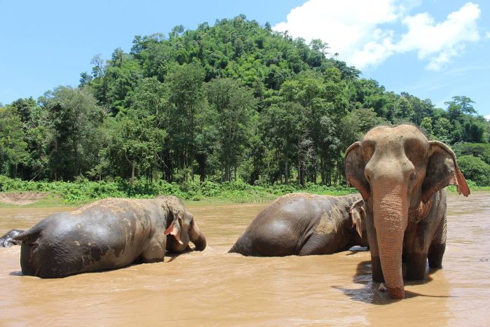
One of the larger operations is reported to be ending its feeding interactions from April 2026 and moving towards observation only. The argument, and the questions worth putting to an operator, are on the ethical travel in Thailand page.
The hill peoples usually named in the north are the Akha, Hmong, Karen, Lahu, Lawa, Lisu and Mien, the last of whom are also called Yao and trace their origins to southern China. Trekking to their villages is one of the things people come here for. Responsible-travel operators argue that the villages closest to the city have been reduced to a two-hour coach stop with performances and non-local goods, and they press for small groups and for money that reaches the village directly.
Staying longer
Nimmanhaemin, west of the moat and next to Chiang Mai University, is the quarter associated with the city's long-stay and remote-working population. A long-stay route for remote workers, the Destination Thailand Visa (DTV), was introduced in 2024, and applications are made from outside Thailand through the official Thai e-Visa portal. Its terms have changed since it opened, so read them there, and the Thai tourist visas and visa runs guide covers the tourist-entry side.
Getting around the city
The airport's own transport page lists a city bus, route R3, running two loops in opposite directions that between them call at Wualai Road, Chiang Mai Gate, the Night Bazaar, Anusarn Market, Tha Phae Gate, Chang Phuak Gate, Kad Suan Kaew, Nimmanhaemin, Suan Dok, Warorot Market and Ton Lamyai Market. The city bus lines run from 06:00 to 23:30. One flat fare covers the whole route, whether you ride two stops or the whole loop.
Red songthaews are shared pickup trucks with no fixed route. You flag one down, name your destination and pay when you get out. Tuk-tuks and Grab both operate, and Grab quotes you a price before you accept it.
Metered street taxis are not the norm here in the way they are in Bangkok. Songthaew and tuk-tuk fares are not published, and the estimates in circulation disagree with each other, so the price is agreed before you get in.